
1954 Map of Placitas
USGS Topo · Published 1955About this map
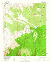
San Antonio de las Huertas Grant and the San Felipe Pueblo Grant dominate this mid-century New Mexico landscape, illustrating the complex overlap of Spanish land grants and tribal lands. The settlement of Placitas serves as a central hub, while the surrounding terrain is marked by deep arroyos and canyons like Las Huertas Creek and Perdiz Canyon. Evidence of earlier resource extraction is visible in several features including a Coal Mine (Aband) and other abandoned mines scattered near the Crest of Montezuma.
Find a feature on this map
49 named features on this map. Tap any name to fly to it.
Don’t see what you’re looking for? This feature index may not catch every label — zoom into the map to look around manually.
Map Details
Editions of this 1954 Placitas Map
4 editions found
Other maps of this area

1888 · Bernalillo
USGS Topo · 1:125,000

1889 · Albuquerque
USGS Topo · 1:125,000

1892 · San Pedro
USGS Topo · 1:125,000

1893 · Albuquerque
USGS Topo · 1:125,000

1934 · Alameda
USGS Topo · 1:24,000

1938 · Albuquerque
USGS Topo · 1:62,500

1954 · Sandia Crest
USGS Topo · 1:24,000

1954 · Alameda
USGS Topo · 1:24,000

1954 · San Felipe Pueblo
USGS Topo · 1:24,000

1954 · Sandia Park
USGS Topo · 1:24,000