
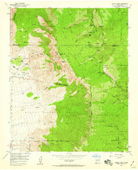
1954 Map of Sandia Crest
USGS Topo · Published 1955About this map
Sandia Crest towers over this mid-century landscape, marking a period when these peaks were becoming established for both recreation and modern communication. The 1954 field check reveals the early infrastructure of the La Madera Ski Area and the Tree Spring Winter Sports Area, alongside technical developments like the Radio and TV Towers at the summit. Historically significant land grants, including the Sandia Pueblo Grant and Elena Gallegos Grant, define the regional boundaries.
Find a feature on this map
85 named features on this map. Tap any name to fly to it.
Don’t see what you’re looking for? This feature index may not catch every label — zoom into the map to look around manually.
Map Details
Editions of this 1954 Sandia Crest Map
2 editions found
Other maps of this area

1888 · Bernalillo
USGS Topo · 1:125,000

1889 · Albuquerque
USGS Topo · 1:125,000

1892 · San Pedro
USGS Topo · 1:125,000

1893 · Albuquerque
USGS Topo · 1:125,000

1934 · Alameda
USGS Topo · 1:24,000

1934 · East Albuquerque
USGS Topo · 1:24,000

1938 · Albuquerque
USGS Topo · 1:62,500

1954 · Alameda
USGS Topo · 1:24,000

1954 · Placitas
USGS Topo · 1:24,000

1954 · Sandia Park
USGS Topo · 1:24,000
Featured Places
- Albuquerque, NM
- Cedar Crest, NM
- Evergreen Hills Subdivision, NM
- Cooper LS Ranch, NM
- Glenwood Hills, Albuquerque