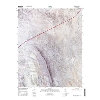
2017 Map of San Felipe Pueblo NE
USGS Topo · Published 2017About this map
The Mormon Battalion Monument stands as a prominent historical landmark in this corner of Sandoval County, marking the legacy of the mid-19th century military expedition through the high desert. The landscape is defined by its complex drainage network, primarily the westward-flowing Arroyo de la Vega de los Tanos and its southern tributaries, Arroyo Largo and Arroyo del Tuerto. These seasonal watercourses dictate the topography of the region, carving deep paths through the terrain. Transportation in the area is a mix of modern infrastructure and local access roads, including the Indian Svc Rte 844 and residential lanes such as Cam Don Pablo and Cam De Dolores. The map detail captures the intersection of historical memory and the natural arroyo systems that have long shaped navigation in this part of New Mexico.
Find a feature on this map
20 named features on this map. Tap any name to fly to it.
Don’t see what you’re looking for? This feature index may not catch every label — zoom into the map to look around manually.
Map Details
Editions of this 2017 San Felipe Pueblo NE Map
This is the sole edition of this map. No revisions or reprints were ever made.
Other maps of this area

1892 · San Pedro
USGS Topo · 1:125,000

1892 · Santa Clara
USGS Topo · 1:125,000

1953 · Santo Domingo Pueblo
USGS Topo · 1:24,000

1953 · Tetilla Peak
USGS Topo · 1:24,000

1953 · Santo Domingo Pueblo SW
USGS Topo · 1:24,000

1953 · Agua Fria
USGS Topo · 1:62,500

1953 · Santo Domingo Pueblo
USGS Topo · 1:62,500

1954 · San Felipe Pueblo
USGS Topo · 1:24,000

1954 · Placitas
USGS Topo · 1:24,000

1954 · San Felipe Pueblo NE
USGS Topo · 1:24,000