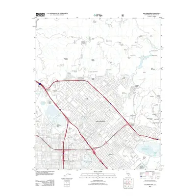
2012 Map of San Fernando
USGS Topo · Published 2012About this map
The city of San Fernando serves as the focal point of this 2012 survey, revealing the complex infrastructure of the northern Los Angeles basin. This urban landscape is defined by its extensive water management systems, including the Pacoima Spreading Grounds and the Hansen Flood Control Basin, which contain Hansen Lake and Middle Lake. To the west, the Van Norman Bypass Reservoir and Lower Van Norman Lake highlight the critical water storage footprint required by the region.
Find a feature on this map
154 named features on this map. Tap any name to fly to it.
Don’t see what you’re looking for? This feature index may not catch every label — zoom into the map to look around manually.
Map Details
Editions of this 2012 San Fernando Map
This is the sole edition of this map. No revisions or reprints were ever made.
Other maps of this area

1894 · Los Angeles
USGS Topo · 1:62,500

1896 · Santa Monica
USGS Topo · 1:62,500

1898 · Santa Monica
USGS Topo · 1:62,500

1900 · Los Angeles
USGS Topo · 1:62,500

1900 · Fernando
USGS Topo · 1:62,500

1901 · Southern California Sheet No. 1
USGS Topo · 1:250,000

1902 · Santa Monica
USGS Topo · 1:62,500

1903 · Calabasas
USGS Topo · 1:62,500

1903 · Camulos
USGS Topo · 1:125,000

1903 · Santa Susana
USGS Topo · 1:62,500