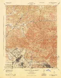
1945 Map of San Fernando
USGS Topo · Published 1945About this map
San Fernando serves as the focal point of this mid-century study, showing the city's grid emerging within the broader San Fernando Valley. The landscape is defined by the stark transition from the alluvial washes of Tujunga Wash and Pacoima Wash to the steep elevations of the San Gabriel Mountains. Cultural landmarks like the San Fernando Mission and the sprawling boundary of Ex Mission San Fernando highlight the region's deep historical roots. The Southern Pacific railroad is a primary artery through the terrain, connecting small sidings and communities such as Honby, Thompson, and Humphreys. In the canyons to the north, numerous drainage systems like Soledad Canyon and Mint Canyon converge toward the Santa Clara River, illustrating the complex hydrology that shaped early development and transportation routes in Los Angeles County.
Find a feature on this map
57 named features on this map. Tap any name to fly to it.
Don’t see what you’re looking for? This feature index may not catch every label — zoom into the map to look around manually.
Map Details
Editions of this 1945 San Fernando Map
This is the sole edition of this map. No revisions or reprints were ever made.
Other maps of this area

1894 · Los Angeles
USGS Topo · 1:62,500

1896 · Pasadena
USGS Topo · 1:62,500

1896 · Santa Monica
USGS Topo · 1:62,500

1898 · Santa Monica
USGS Topo · 1:62,500

1900 · Pasadena
USGS Topo · 1:62,500

1900 · Tujunga
USGS Topo · 1:62,500

1900 · Los Angeles
USGS Topo · 1:62,500

1900 · Fernando
USGS Topo · 1:62,500

1901 · Southern California Sheet No. 1
USGS Topo · 1:250,000

1902 · Santa Monica
USGS Topo · 1:62,500