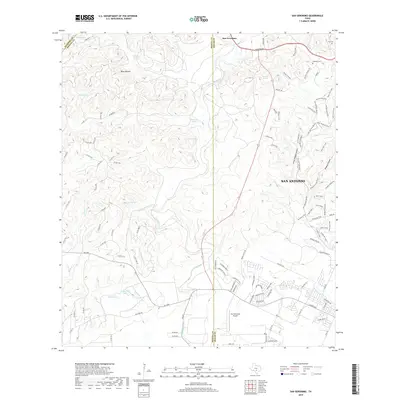
2019 Map of San Geronimo
USGS Topo · Published 2019About this map
San Geronimo sits at the nexus of several Hill Country counties, where the high ground of Helotes Ridge gives way to the drainage systems of the San Geronimo Creek and Mesquite Creek. This modern survey reveals a landscape deeply influenced by its karst topography, dotted with numerous named water sources such as Indian Mound Springs, Pecan Spring, and Honeymoon Spring. These springs and seasonal creeks historically dictated the placement of early ranching infrastructure and settlements.
Find a feature on this map
107 named features on this map. Tap any name to fly to it.
Don’t see what you’re looking for? This feature index may not catch every label — zoom into the map to look around manually.
Map Details
Editions of this 2019 San Geronimo Map
This is the sole edition of this map. No revisions or reprints were ever made.
Other maps of this area

1953 · Culebra Hill
USGS Topo · 1:24,000

1953 · Helotes
USGS Topo · 1:24,000

1953 · Van Raub
USGS Topo · 1:24,000

1954 · San Antonio
USGS Topo · 1:250,000

1956 · Medina Lake
USGS Topo · 1:62,500

1957 · San Antonio
USGS Topo · 1:250,000

1958 · La Coste NE
USGS Topo · 1:24,000

1964 · Riomedina
USGS Topo · 1:24,000

1964 · Medina Lake
USGS Topo · 1:24,000
1966 · Culebra Hill
USGS Topo · 1:24,000