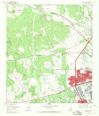
1966 Map of Culebra Hill
USGS Topo · Published 1969About this map
The western outskirts of San Antonio are undergoing a mid-century transformation on this sheet, defined by the expanding footprints of Lackland Air Force Base and Medina Base. While the northwestern corner retains a more rural character around Culebra Hill and the Cordi-Marian Villa Convent and Chapel, the southeastern quadrant is characterized by rapid suburban development. Planned residential communities such as Lackland Heights, Kelland Heights, and Westwood Village emerge alongside institutional landmarks like the Southwest Foundation for Research and Education. This era shows a landscape in flux, where traditional sites like the Sociedad Cem sit near modern infrastructure, including the John Jay High Sch and several large gravel operations. The network of creeks, including Medio Creek and Culebra Creek, remains a constant geographic thread through both the old ranch lands and the new air base housing.
Find a feature on this map
57 named features on this map. Tap any name to fly to it.
Don’t see what you’re looking for? This feature index may not catch every label — zoom into the map to look around manually.
Map Details
Editions of this 1966 Culebra Hill Map
Other maps of this area

1953 · Culebra Hill
USGS Topo · 1:24,000

1953 · San Antonio West
USGS Topo · 1:24,000

1953 · Terrell Wells
USGS Topo · 1:24,000

1953 · Macdona
USGS Topo · 1:24,000

1953 · Helotes
USGS Topo · 1:24,000

1953 · Castle Hills
USGS Topo · 1:24,000

1954 · San Antonio
USGS Topo · 1:250,000

1956 · Medina Lake
USGS Topo · 1:62,500

1957 · San Antonio
USGS Topo · 1:250,000

1958 · La Coste
USGS Topo · 1:24,000