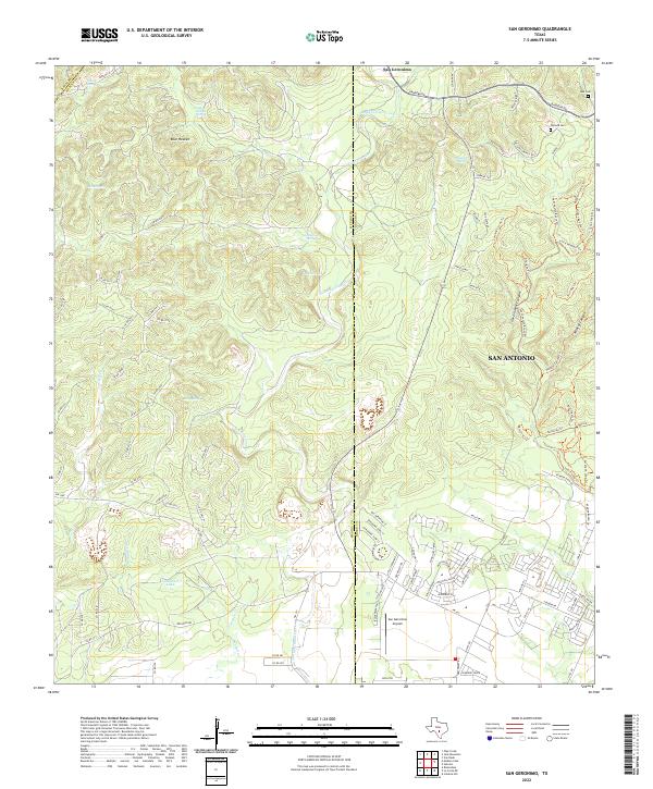
2022 Map of San Geronimo
USGS Topo · Published 2022About this map
San Geronimo and the surrounding Hill Country terrain define this landscape at the intersection of Medina, Bexar, and Bandera counties. The topography is marked by significant drainages such as San Geronimo Creek and Mesquite Cr, which flow through a network of canyons including Walnut Canyon and Government Canyon. Local water sources are abundant, with numerous named features such as Indian Mound Springs, Cherry Spring, and Honeymoon Spring scattered across the limestone hills. Cultural markers include the Lee Cem and Cepeda Cem near the eastern boundary, while the San Geronimo Airpark indicates modern aviation infrastructure in the valley. The settlement pattern shows a shift from the clustered community of Blue Heaven to the expanding suburban reach of San Antonio in the southeast.
Find a feature on this map
108 named features on this map. Tap any name to fly to it.
Don’t see what you’re looking for? This feature index may not catch every label — zoom into the map to look around manually.
Map Details
Editions of this 2022 San Geronimo Map
This is the sole edition of this map. No revisions or reprints were ever made.
Other maps of this area

1953 · Culebra Hill
USGS Topo · 1:24,000

1953 · Helotes
USGS Topo · 1:24,000

1953 · Van Raub
USGS Topo · 1:24,000

1954 · San Antonio
USGS Topo · 1:250,000

1956 · Medina Lake
USGS Topo · 1:62,500

1957 · San Antonio
USGS Topo · 1:250,000

1958 · La Coste NE
USGS Topo · 1:24,000

1964 · Riomedina
USGS Topo · 1:24,000

1964 · Medina Lake
USGS Topo · 1:24,000
1966 · Culebra Hill
USGS Topo · 1:24,000