
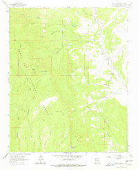
1961 Map of San Geronimo
USGS Topo · Published 1965About this map
San Geronimo sits at the eastern edge of the mountainous terrain where Tecolote Creek winds through the landscape. This 1961 field-checked survey highlights the transition from the high peaks of the Santa Fe National Forest to the ranching and settlement areas of San Miguel County. Genealogy researchers can identify the local Cem and specific homesteads like Shearer Ranch or the San Geronimo Cabin. The geography is defined by a dense network of watercourses and canyons, including San Pablo Creek and Tres Hermanos Canyon. Industrial and utilitarian activity is evidenced by a Mine and a Lookout Tower positioned on high ground near Barillas Peak. The map also delineates a significant Grant Boundary that bisects the region, reflecting the complex land ownership history of northern New Mexico.
Find a feature on this map
34 named features on this map. Tap any name to fly to it.
Don’t see what you’re looking for? This feature index may not catch every label — zoom into the map to look around manually.
Map Details
Editions of this 1961 San Geronimo Map
2 editions found
Other maps of this area

1889 · Las Vegas
USGS Topo · 1:125,000

1889 · Santa Fe
USGS Topo · 1:125,000

1890 · Bernal
USGS Topo · 1:125,000

1891 · Bernal
USGS Topo · 1:125,000

1891 · Las Vegas
USGS Topo · 1:125,000

1893 · Las Vegas
USGS Topo · 1:125,000

1894 · Santa Fe
USGS Topo · 1:125,000

1894 · Bernal
USGS Topo · 1:125,000

1894 · Lamy
USGS Topo · 1:125,000

1954 · Santa Fe
USGS Topo · 1:250,000