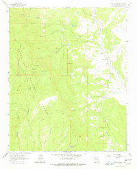
1961 Map of San Geronimo
USGS Topo · Published 1978About this map
Santa Fe National Forest dominates the high country in this mid-century survey of San Miguel County, where steep drainages like Sebadilla Creek and Barillas Creek carve through the mountain terrain. The map captures a rural landscape defined by small settlements and isolated outposts, notably San Geronimo and San Pablo, the latter of which includes a local Cem. High elevations are marked by Barillas Peak, topped with a Lookout Tower, and the prominent El Barro Peaks to the south.
Find a feature on this map
35 named features on this map. Tap any name to fly to it.
Don’t see what you’re looking for? This feature index may not catch every label — zoom into the map to look around manually.
Map Details
Editions of this 1961 San Geronimo Map
2 editions found

Other maps of this area

1889 · Las Vegas
USGS Topo · 1:125,000

1889 · Santa Fe
USGS Topo · 1:125,000

1890 · Bernal
USGS Topo · 1:125,000

1891 · Bernal
USGS Topo · 1:125,000

1891 · Las Vegas
USGS Topo · 1:125,000

1893 · Las Vegas
USGS Topo · 1:125,000

1894 · Santa Fe
USGS Topo · 1:125,000

1894 · Bernal
USGS Topo · 1:125,000

1894 · Lamy
USGS Topo · 1:125,000

1954 · Santa Fe
USGS Topo · 1:250,000