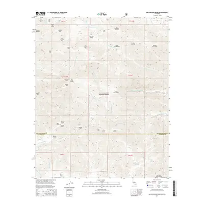
2015 Map of San Gorgonio Mountain
USGS Topo · Published 2015About this map
San Gorgonio Mtn dominates this high-altitude landscape, anchoring the eastern reach of the San Bernardino National Forest. The map documents a complex hydrological system where the headwaters of several major drainages diverge, including the S Fork Santa Ana River, San Gorgonio River, and the various branches of the Whitewater River. Alpine water features like Dollar Lake and Dry Lake are joined by scattered water sources such as Lodgepole Spring and High Meadow Springs, which historically served as vital stops for those navigating the high country.
Find a feature on this map
58 named features on this map. Tap any name to fly to it.
Don’t see what you’re looking for? This feature index may not catch every label — zoom into the map to look around manually.
Map Details
Editions of this 2015 San Gorgonio Mountain Map
This is the sole edition of this map. No revisions or reprints were ever made.
Other maps of this area

1901 · Southern California Sheet No. 1
USGS Topo · 1:250,000

1901 · San Jacinto
USGS Topo · 1:125,000

1902 · San Gorgonio
USGS Topo · 1:125,000

1904 · Southern California Sheet No. 1
USGS Topo · 1:250,000

1940 · Palm Springs
USGS Topo · 1:62,500

1942 · Banning
USGS Topo · 1:62,500

1943 · Banning
USGS Topo · 1:62,500

1944 · Palm Springs
USGS Topo · 1:62,500

1947 · Santa Ana
USGS Topo · 1:250,000

1949 · Santa Ana
USGS Topo · 1:250,000