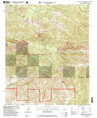
1996 Map of San Gorgonio Mountain
USGS Topo · Published 1999About this map
San Gorgonio Mountain stands as the central focal point of this high-altitude landscape, anchoring the eastern end of the Transverse Ranges. The terrain is defined by extreme relief, featuring prominent summits like Charlton Peak, Jepson Peak, and the long traverse of Ten Thousand Foot Ridge. Historically, this area served as a critical watershed and a site of early alpine exploration, evidenced by the network of campsites including Summit Campsite and High Creek Campsite.
Find a feature on this map
59 named features on this map. Tap any name to fly to it.
Don’t see what you’re looking for? This feature index may not catch every label — zoom into the map to look around manually.
Map Details
Editions of this 1996 San Gorgonio Mountain Map
This is the sole edition of this map. No revisions or reprints were ever made.
Other maps of this area

1901 · Southern California Sheet No. 1
USGS Topo · 1:250,000

1901 · San Jacinto
USGS Topo · 1:125,000

1902 · San Gorgonio
USGS Topo · 1:125,000

1904 · Southern California Sheet No. 1
USGS Topo · 1:250,000

1940 · Palm Springs
USGS Topo · 1:62,500

1942 · Banning
USGS Topo · 1:62,500

1943 · Banning
USGS Topo · 1:62,500

1944 · Palm Springs
USGS Topo · 1:62,500

1947 · Santa Ana
USGS Topo · 1:250,000

1949 · Santa Ana
USGS Topo · 1:250,000