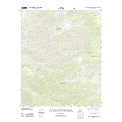
2012 Map of San Guillermo Mountain
USGS Topo · Published 2012About this map
San Guillermo Mountain stands as the central landmark in this high-elevation region of Ventura County, where the Los Padres National Forest landscape is defined by deep canyons and seasonal watercourses. The northern portion of the map is dominated by the broad expanse of Lockwood Valley, a high-country basin accessed via Lockwood Valley Rd. This area reveals a sparse pattern of human activity centered around the Plush Ranch and the Boy Scout facilities at Camp Three Falls.
Find a feature on this map
21 named features on this map. Tap any name to fly to it.
Don’t see what you’re looking for? This feature index may not catch every label — zoom into the map to look around manually.
Map Details
Editions of this 2012 San Guillermo Mountain Map
This is the sole edition of this map. No revisions or reprints were ever made.
Other maps of this area

1903 · Mt. Pinos
USGS Topo · 1:125,000

1942 · Wheeler Springs
USGS Topo · 1:24,000

1943 · Topatopa Mountains
USGS Topo · 1:24,000

1943 · Apache Canyon
USGS Topo · 1:24,000

1943 · San Guillermo
USGS Topo · 1:24,000

1943 · Sawmill Mountain
USGS Topo · 1:24,000

1943 · Cuddy Valley
USGS Topo · 1:24,000

1943 · Lockwood Valley
USGS Topo · 1:24,000

1943 · Lion Canyon
USGS Topo · 1:24,000

1943 · Reyes Peak
USGS Topo · 1:24,000