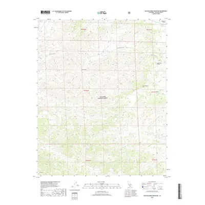
2018 Map of San Guillermo Mountain
USGS Topo · Published 2018About this map
Los Padres National Forest encompasses this high-elevation terrain in Ventura County, where the landscape is defined by the prominent peak of San Guillermo Mtn and the long expanse of Lockwood Valley. The map details a complex network of seasonal and perennial watercourses, including the upper reaches of Piru Cr and the westward-flowing Alamo Cr. A single paved artery, Lockwood Valley Rd, provides access through the valley, connecting remote canyons like Wagon Road Canyon and Park Canyon to the broader region. This late-2010s survey captures the area's preservation as a protected wilderness, characterized by steep ridgelines such as Pine Mtn and remote water sources like Pine Spring. The presence of numerous creek branches, including Beartrap Cr and Piedra Blanca Cr, illustrates the drainage patterns vital to this part of the California coastal range.
Find a feature on this map
21 named features on this map. Tap any name to fly to it.
Don’t see what you’re looking for? This feature index may not catch every label — zoom into the map to look around manually.
Map Details
Editions of this 2018 San Guillermo Mountain Map
This is the sole edition of this map. No revisions or reprints were ever made.
Other maps of this area

1903 · Mt. Pinos
USGS Topo · 1:125,000

1942 · Wheeler Springs
USGS Topo · 1:24,000

1943 · Topatopa Mountains
USGS Topo · 1:24,000

1943 · Apache Canyon
USGS Topo · 1:24,000

1943 · San Guillermo
USGS Topo · 1:24,000

1943 · Sawmill Mountain
USGS Topo · 1:24,000

1943 · Cuddy Valley
USGS Topo · 1:24,000

1943 · Lockwood Valley
USGS Topo · 1:24,000

1943 · Lion Canyon
USGS Topo · 1:24,000

1943 · Reyes Peak
USGS Topo · 1:24,000