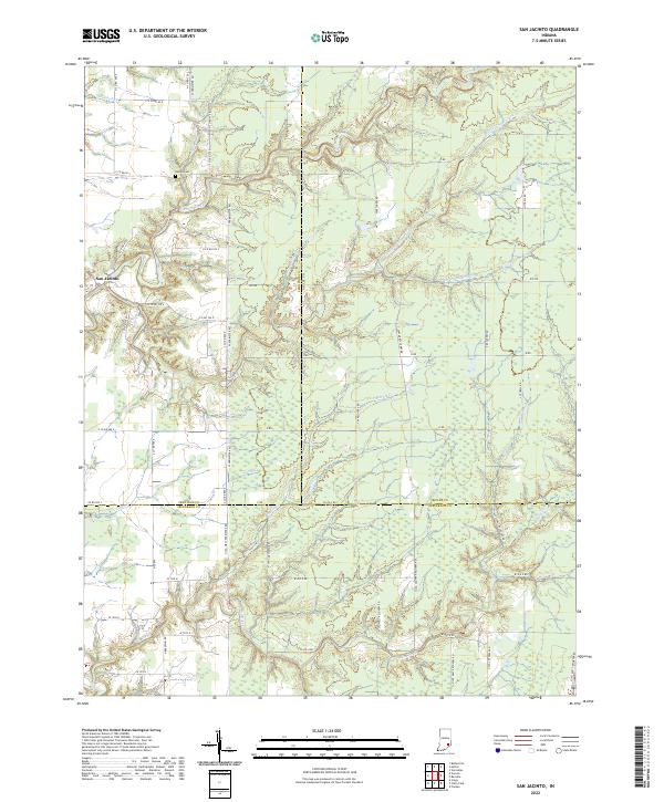
2022 Map of San Jacinto
USGS Topo · Published 2022About this map
San Jacinto sits at the intersection of rural routes where the borders of Jennings, Ripley, and Jefferson counties converge. This landscape is defined by the dendritic drainage patterns of Big Creek and Graham Creek, which carve through the terrain and dictate the local road network. Evidence of early settlement is anchored by Bethel Cem near Crooked Cr, while the southern half of the map is dominated by a transition into the Jefferson Proving Ground area, indicated by restricted access roads like N JPG West Perimeter Rd and N JPG Center Recovery Rd. The network of backroads, including Eye Rd and J Rd, connects disparate farmsteads and agricultural plots that have shaped this corner of Indiana for generations. Smaller tributaries such as Marble Cr and Horse and Poplar Br further segment the woodlots and fields of this tri-county region.
Find a feature on this map
55 named features on this map. Tap any name to fly to it.
Don’t see what you’re looking for? This feature index may not catch every label — zoom into the map to look around manually.
Map Details
Editions of this 2022 San Jacinto Map
This is the sole edition of this map. No revisions or reprints were ever made.
Other maps of this area

1942 · Columbus
USGS Topo · 1:125,000

1946 · Versailles
USGS Topo · 1:24,000

1953 · Cincinnati
USGS Topo · 1:250,000

1956 · Volga
USGS Topo · 1:24,000

1956 · Clifty Falls
USGS Topo · 1:24,000

1956 · Canaan
USGS Topo · 1:24,000

1956 · Louisville
USGS Topo · 1:250,000

1957 · Cincinnati
USGS Topo · 1:250,000

1957 · Butlerville
USGS Topo · 1:24,000

1959 · Holton
USGS Topo · 1:24,000