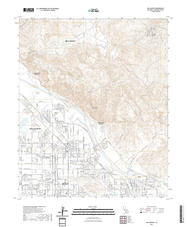
2021 Map of San Jacinto
USGS Topo · Published 2021About this map
The San Jacinto Valley serves as a dense residential and civic corridor between the towering San Jacinto Mountains and the rising ground of Park Hill. This modern survey details the transition from the city of San Jacinto south into Hemet, where the Riverside County Hemet Courthouse and the San Jacinto Valley Cem anchor the community's historical and administrative center. The landscape is heavily influenced by water management, notably the San Diego Aqueduct and the San Jacinto Reservoir, which support the region's development along the San Jacinto River.
Find a feature on this map
47 named features on this map. Tap any name to fly to it.
Don’t see what you’re looking for? This feature index may not catch every label — zoom into the map to look around manually.
Map Details
Editions of this 2021 San Jacinto Map
This is the sole edition of this map. No revisions or reprints were ever made.
Other maps of this area

1901 · Southern California Sheet No. 1
USGS Topo · 1:250,000

1901 · San Jacinto
USGS Topo · 1:125,000

1901 · Elsinore
USGS Topo · 1:125,000

1904 · Southern California Sheet No. 1
USGS Topo · 1:250,000

1942 · Banning
USGS Topo · 1:62,500

1942 · Hemet
USGS Topo · 1:62,500

1942 · Murrieta
USGS Topo · 1:62,500

1942 · Perris
USGS Topo · 1:62,500

1943 · Perris
USGS Topo · 1:62,500

1943 · Hemet
USGS Topo · 1:62,500