1889 Map of San Jose
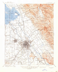
USGS Topo · Published 1946About this map
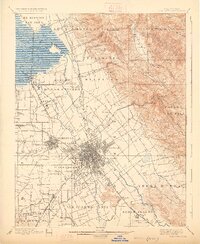
San Jose and the surrounding Santa Clara Valley appear here during a period of agricultural dominance, before the suburban sprawl of the twentieth century. The grid of the city center is flanked by outlying settlements like Willow Glen, East San Jose, and Campbell, while the northern landscape is defined by the marshy reaches of Coyote Creek and Alviso Slough. A network of rail lines, including the Southern Pacific R. R. and the San Jose Branch, crisscrosses the valley floor, highlighting the importance of transit for the region's burgeoning economy.
Find a feature on this map
79 named features on this map. Tap any name to fly to it.
Don’t see what you’re looking for? This feature index may not catch every label — zoom into the map to look around manually.
Map Details
Editions of this 1889 San Jose Map
2 editions found

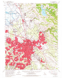
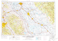
Historical Maps of San Jose Through Time
11 maps found
1889 San Jose
Santa Clara County, CA

1897 San Jose
Santa Clara County, CA
1899 San Jose
Santa Clara County, CA

1943 San Jose
Santa Clara County, CA

1947 San Jose
Santa Clara County, CA

1953 San Jose
Santa Clara County, CA

1956 San Jose
Santa Clara County, CA
1961 San Jose
Santa Clara County, CA
1962 San Jose
Santa Clara County, CA

1966 San Jose
Santa Clara County, CA

1978 San Jose
Santa Clara County, CA