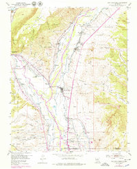
1953 Map of San Juan Pueblo
USGS Topo · Published 1979About this map
The confluence of the Rio Chama and the Rio Grande defines this Northern New Mexico landscape, a region deeply rooted in colonial history. Centered on San Juan Pueblo, the map identifies the site of the Old San Juan First Spanish Capitol 1598, emphasizing the area's significance as an early center of Spanish administration. The valley is crisscrossed by an intricate network of irrigation channels, including the Los Luceros Ditch and Rinconada Isla Ditch, which support small settlements like Alcalde and Los Luceros.
Find a feature on this map
74 named features on this map. Tap any name to fly to it.
Don’t see what you’re looking for? This feature index may not catch every label — zoom into the map to look around manually.
Map Details
Editions of this 1953 San Juan Pueblo Map
4 editions found
Other maps of this area

1889 · Santa Fe
USGS Topo · 1:125,000

1892 · Santa Clara
USGS Topo · 1:125,000

1894 · Santa Fe
USGS Topo · 1:125,000

1918 · Abiquiu
USGS Topo · 1:125,000

1952 · Puye
USGS Topo · 1:24,000

1953 · Espanola
USGS Topo · 1:24,000

1953 · Chili
USGS Topo · 1:24,000

1953 · Medanales
USGS Topo · 1:24,000

1953 · San Juan Pueblo
USGS Topo · 1:24,000

1953 · Lyden
USGS Topo · 1:24,000