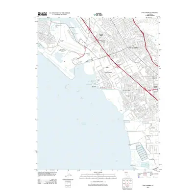
2012 Map of San Leandro
USGS Topo · Published 2012About this map
San Leandro and its neighboring East Bay communities are defined by a complex coastal interface where the urban grid meets the Pacific Ocean. This survey illustrates the high concentration of maritime and aviation infrastructure that fuels the regional economy, from the sprawling Metropolitan Oakland International Airport in the north to the Hayward Executive Airport in the south. The shoreline is punctuated by functional landmarks like San Leandro Marina and several historical landings, including Roberts Landing and Johnson Landing.
Find a feature on this map
48 named features on this map. Tap any name to fly to it.
Don’t see what you’re looking for? This feature index may not catch every label — zoom into the map to look around manually.
Map Details
Editions of this 2012 San Leandro Map
This is the sole edition of this map. No revisions or reprints were ever made.
Other maps of this area

1892 · San Mateo
USGS Topo · 1:62,500

1895 · San Francisco
USGS Topo · 1:62,500

1896 · San Mateo
USGS Topo · 1:62,500

1897 · Concord
USGS Topo · 1:62,500

1899 · San Francisco
USGS Topo · 1:62,500

1899 · Haywards
USGS Topo · 1:62,500

1899 · San Mateo
USGS Topo · 1:62,500

1915 · San Mateo
USGS Topo · 1:62,500

1915 · Haywards
USGS Topo · 1:62,500

1915 · Concord
USGS Topo · 1:62,500