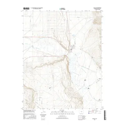
2016 Map of San Luis
USGS Topo · Published 2016About this map
The town of San Luis stands as a central hub on this high-altitude landscape, where the ancient and essential practice of irrigation is clearly documented. The map reveals an intricate network of waterways supporting the valley, including the historic San Luis Peoples Ditch and the Cerro Ditch Number 2. These systems draw from Culebra Creek and Rito Seco to sustain a string of small settlements. Traveling south along the base of the prominent San Pedro Mesa, the landscape transitions through the communities of San Pedro, San Pablo, and Chama. For those researching family roots in Costilla County, the presence of the San Pedro Cemetery and residential grids like those on Casa Verde Real and Alfonso St offer precise geographic points of interest. The area’s modern utility is also represented by the San Luis Airport and the expansive Salazar Reservoir, reflecting a balance of historical agriculture and regional infrastructure.
Find a feature on this map
66 named features on this map. Tap any name to fly to it.
Don’t see what you’re looking for? This feature index may not catch every label — zoom into the map to look around manually.
Map Details
Editions of this 2016 San Luis Map
This is the sole edition of this map. No revisions or reprints were ever made.
Other maps of this area

1954 · Trinidad
USGS Topo · 1:250,000

1955 · Trinidad
USGS Topo · 1:250,000

1958 · Trinidad
USGS Topo · 1:250,000

1959 · Trinidad
USGS Topo · 1:250,000

1965 · Blanca SE
USGS Topo · 1:24,000

1967 · San Luis
USGS Topo · 1:24,000

1967 · La Valley
USGS Topo · 1:24,000

1967 · Fort Garland SW
USGS Topo · 1:24,000

1967 · Ojito Peak
USGS Topo · 1:24,000

1967 · Taylor Ranch
USGS Topo · 1:24,000