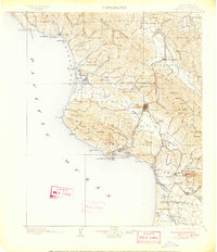
1900 Map of San Luis
USGS Topo · Published 1906About this map
San Luis Obispo serves as the inland anchor of this late nineteenth-century coastal landscape, connected to the sea via the Southern Pacific Railroad and the shipping infrastructure at Port Harford. The map reveals a coastal economy transitioning from maritime commerce at Mallagh Landing to terrestrial resource extraction, evidenced by the Asphalt Mines near Avila and the Goldtree site. Coastal settlements like Cayucos and Morro are depicted in their early development, while the iconic Morro Rock stands as a primary navigational landmark at the mouth of Morro Bay. To the north, the Salinas River headwaters emerge near Santa Margarita, marking the divide between the coastal valleys and the interior. The presence of numerous family-named landmarks like Hollister Peak and Lopez Mt. suggests the deep-rooted ranching and homesteading history of the central coast before modern suburban expansion.
Find a feature on this map
117 named features on this map. Tap any name to fly to it.
Don’t see what you’re looking for? This feature index may not catch every label — zoom into the map to look around manually.
Map Details
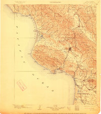
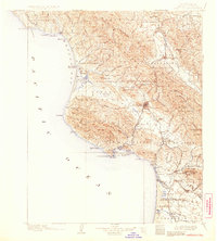
Editions of this 1900 San Luis Map
4 editions found
Other maps of this area

1897 · Port Harford
USGS Topo · 1:62,500

1897 · San Luis Obispo
USGS Topo · 1:62,500

1897 · Cayucos
USGS Topo · 1:62,500

1897 · Arroyo Grande
USGS Topo · 1:62,500

1900 · San Luis
USGS Topo · 1:125,000

1905 · Guadalupe
USGS Topo · 1:125,000

1905 · Lompoc
USGS Topo · 1:125,000

1914 · Cholame
USGS Topo · 1:125,000

1915 · Cholame
USGS Topo · 1:125,000

1917 · Cholame
USGS Topo · 1:125,000