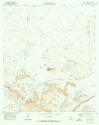
1970 Map of San Martine
USGS Topo · Published 1973About this map
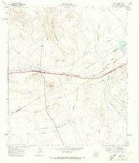
The arid ranching landscape of West Texas is documented in this 1970 survey, where the border of Culberson Co Reeves Co cuts through a terrain defined by cattle tanks and intermittent watercourses. Named for the prominent San Martine Draw, the area centers on the reliable Seven Heart Crossing where the tracks of the Texas and Pacific railroad traverse the desert.
Find a feature on this map
32 named features on this map. Tap any name to fly to it.
Don’t see what you’re looking for? This feature index may not catch every label — zoom into the map to look around manually.
Map Details
Editions of this 1970 San Martine Map
This is the sole edition of this map. No revisions or reprints were ever made.
Other maps of this area

1921 · Toyah
USGS Topo · 1:125,000

1928 · Kent
USGS Topo · 1:125,000

1954 · Van Horn
USGS Topo · 1:250,000

1954 · Pecos
USGS Topo · 1:250,000

1957 · Pecos
USGS Topo · 1:250,000

1958 · Van Horn
USGS Topo · 1:250,000
1970 · Gozar
USGS Topo · 1:24,000
1970 · Toyah SW
USGS Topo · 1:24,000
1970 · Gomez Peak
USGS Topo · 1:24,000
1970 · Kent
USGS Topo · 1:24,000