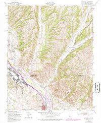
1948 Map of San Miguel
USGS Topo · Published 1979About this map
San Miguel sits at the southern edge of this landscape, positioned where the Southern Pacific railroad follows the winding course of the Salinas River. To the west, the sprawling footprint of the Camp Roberts Military Reservation occupies the heights above the river valley, marked by its Landing Strip and Athletic Field. This mid-century survey captures the region as it transitioned from a military-focused corridor into its established rural and agricultural character.
Find a feature on this map
22 named features on this map. Tap any name to fly to it.
Don’t see what you’re looking for? This feature index may not catch every label — zoom into the map to look around manually.
Map Details
Editions of this 1948 San Miguel Map
4 editions found
Other maps of this area

1919 · San Miguel
USGS Topo · 1:62,500

1919 · Paso Robles
USGS Topo · 1:62,500

1919 · Bradley
USGS Topo · 1:62,500

1919 · Adelaida
USGS Topo · 1:62,500

1932 · Adelaida
USGS Topo · 1:62,500

1941 · Bradley
USGS Topo · 1:62,500

1942 · Adelaida
USGS Topo · 1:62,500

1943 · Paso Robles
USGS Topo · 1:62,500

1947 · San Luis Obispo
USGS Topo · 1:250,000

1947 · San Miguel
USGS Topo · 1:62,500