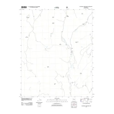
2011 Map of San Miguel Mountain
USGS Topo · Published 2011About this map
San Miguel Mountain dominates the northwestern corner of this high-altitude landscape within the Sierra Nacimiento range. The drainage patterns are defined by the convergence of major watercourses, where the Rio de las Vacas and Rio Cebolla meet to form the Rio Guadalupe. Small settlements and naming points like Porter and O'Neil Landing sit along these riparian corridors, which historically provided vital access in the broken terrain. To the south, the massive Joaquin Mesa rises above several named canyons, including Joaquin Canyon and Caon Cehollita. The abundance of isolated water sources such as Bear Springs, Butterfly Spring, and Bales Seep indicates a landscape heavily utilized for livestock or seasonal mountain activities, while the winding Bales Canyon RD and Fenton Lake RD provide the primary transit routes through the complex topography.
Find a feature on this map
30 named features on this map. Tap any name to fly to it.
Don’t see what you’re looking for? This feature index may not catch every label — zoom into the map to look around manually.
Map Details
Editions of this 2011 San Miguel Mountain Map
This is the sole edition of this map. No revisions or reprints were ever made.
Other maps of this area

1890 · Jemes
USGS Topo · 1:125,000

1892 · Jemes
USGS Topo · 1:125,000

1937 · Jemez Springs
USGS Topo · 1:48,000

1939 · La Ventana
USGS Topo · 1:62,500

1939 · San Ysidro
USGS Topo · 1:62,500

1943 · San Ysidro
USGS Topo · 1:62,500

1943 · Jemez
USGS Topo · 1:62,500

1943 · La Ventana
USGS Topo · 1:62,500

1944 · Jemez Springs
USGS Topo · 1:62,500

1952 · Jemez Springs
USGS Topo · 1:62,500