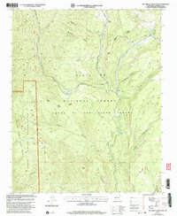
2002 Map of San Miguel Mountain
USGS Topo · Published 2003About this map
San Miguel Mountain anchors this rugged section of the Santa Fe National Forest, where high mesas and deep canyons define the landscape of northern New Mexico. The map details a complex intersection of historic land divisions, including the Cañon de San Diego Grant, the Espiritu Santo Grant, and the Jemez Reservation. Water sources are vital features in this arid terrain, with the Rio Guadalupe and Rio de las Vacas cutting through the center, while numerous named seeps like Rita la Cueva Spring and Llano Loco Spring appear in the backcountry. The small settlement of Porter sits at a junction of river canyons, serving as a rare focal point of human activity amidst the expansive terrain of Mesa Stable and Holiday Mesa. Notable land management boundaries, such as the Cuba Jemez Ranger District, underscore the area's administrative history.
Find a feature on this map
44 named features on this map. Tap any name to fly to it.
Don’t see what you’re looking for? This feature index may not catch every label — zoom into the map to look around manually.
Map Details
Editions of this 2002 San Miguel Mountain Map
This is the sole edition of this map. No revisions or reprints were ever made.
Other maps of this area

1890 · Jemes
USGS Topo · 1:125,000

1892 · Jemes
USGS Topo · 1:125,000

1937 · Jemez Springs
USGS Topo · 1:48,000

1939 · La Ventana
USGS Topo · 1:62,500

1939 · San Ysidro
USGS Topo · 1:62,500

1943 · San Ysidro
USGS Topo · 1:62,500

1943 · Jemez
USGS Topo · 1:62,500

1943 · La Ventana
USGS Topo · 1:62,500

1944 · Jemez Springs
USGS Topo · 1:62,500

1952 · Jemez Springs
USGS Topo · 1:62,500