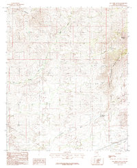
1985 Map of San Pedro Ranch
USGS Topo · Published 1985About this map
Johnny Lyon Hills and the Little Dragoon Mountains dominate this high-desert landscape in southeastern Arizona, where the terrain is defined by a network of seasonal drainage systems. The presence of the San Pedro Ranch indicates the long-standing cattle ranching tradition of Cochise County, situated among the undulating foothills and prominent summits like Mae West Peaks. This 1985 provisional survey captures the intersection of traditional land use and modern infrastructure, shown through the various trans lines and a pipeline that cross the arid basin. Water management and natural flow are highlighted by the prominent Tres Alamos Wash and Sheep Wash, which receive runoff from several major canyons including Texas Canyon and Granite Canyon. These features illustrate the complex topography that has historically challenged and shaped movement through this region of the American Southwest.
Find a feature on this map
17 named features on this map. Tap any name to fly to it.
Don’t see what you’re looking for? This feature index may not catch every label — zoom into the map to look around manually.
Map Details
Editions of this 1985 San Pedro Ranch Map
This is the sole edition of this map. No revisions or reprints were ever made.
Other maps of this area

1915 · Benson
USGS Topo · 1:125,000

1922 · St. David
USGS Topo · 1:62,500

1926 · Whetstone
USGS Topo · 1:62,500

1943 · Benson
USGS Topo · 1:125,000

1943 · Dragoon
USGS Topo · 1:62,500

1945 · Happy Valley
USGS Topo · 1:62,500

1956 · Nogales
USGS Topo · 1:250,000

1956 · Tucson
USGS Topo · 1:250,000

1958 · Nogales
USGS Topo · 1:250,000

1958 · Tucson
USGS Topo · 1:250,000