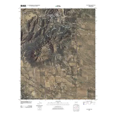
2010 Map of San Pedro
USGS Topo · Published 2010About this map
San Pedro Mountain and the San Pedro Mountains dominate the northern landscape of this Santa Fe County region, revealing a history etched into the earth through extensive mining operations. High-altitude mineral claims such as the Abe Lincoln, Carnahan Mine, and Anaconda Mine are concentrated near San Lazarus Gulch, illustrating the intensive extraction efforts of the era. The settlement of San Pedro sits near the head of Cañon del Agua, while further south, the community of Cedar Grove anchors a valley defined by South Mountain. This 2010 survey also documents essential local landmarks for genealogists, including the San Pedro Cemetery and Hyer Cemetery. The transition from historical mining to modern utility is visible in features like the Horizon Ranch Aerodrome Airport and the residential layout of Homes Valley, providing a detailed look at the area's evolving land use.
Find a feature on this map
97 named features on this map. Tap any name to fly to it.
Don’t see what you’re looking for? This feature index may not catch every label — zoom into the map to look around manually.
Map Details
Editions of this 2010 San Pedro Map
This is the sole edition of this map. No revisions or reprints were ever made.
Other maps of this area

1892 · San Pedro
USGS Topo · 1:125,000

1954 · Sandia Park
USGS Topo · 1:24,000

1954 · San Pedro
USGS Topo · 1:24,000

1954 · Sedillo
USGS Topo · 1:24,000

1954 · Hagan
USGS Topo · 1:24,000

1954 · Edgewood
USGS Topo · 1:24,000

1954 · San Felipe Pueblo
USGS Topo · 1:62,500

1956 · Edgewood
USGS Topo · 1:62,500

1958 · Albuquerque
USGS Topo · 1:250,000

1961 · Madrid
USGS Topo · 1:62,500