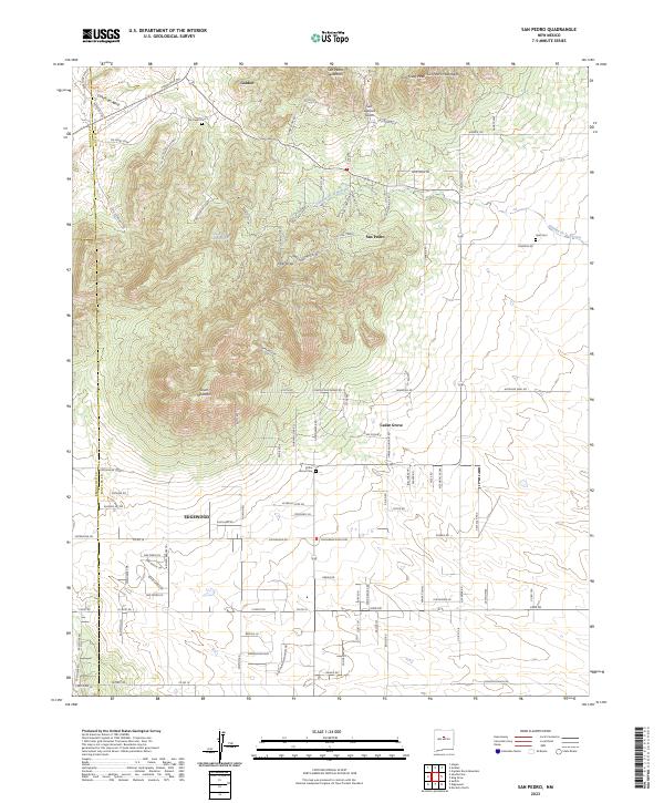
2023 Map of San Pedro
USGS Topo · Published 2023About this map
San Pedro Mountain and South Mountain dominate this high-desert landscape in Santa Fe County, where the transition from rugged peaks to residential valley expansion is clearly visible. The map records a modern network of winding roads like Turquoise Trl and Miners Row Rd that thread through the foothills of the San Pedro Mountains. Historical layers remain evident through the presence of localized burial grounds including San Pedro Cem, Hyer Cem, and Cedar Grove Cem, which serve as vital markers for genealogical research in these small communities. Settlements such as Golden, San Pedro, and Cedar Grove are linked by seasonal drainage features like Cañon del Agua and Cañada de la Narrias, illustrating how local topography continues to dictate the patterns of human habitation and infrastructure in this semi-arid region.
Find a feature on this map
107 named features on this map. Tap any name to fly to it.
Don’t see what you’re looking for? This feature index may not catch every label — zoom into the map to look around manually.
Map Details
Editions of this 2023 San Pedro Map
This is the sole edition of this map. No revisions or reprints were ever made.
Other maps of this area

1892 · San Pedro
USGS Topo · 1:125,000

1954 · Sandia Park
USGS Topo · 1:24,000

1954 · San Pedro
USGS Topo · 1:24,000

1954 · Sedillo
USGS Topo · 1:24,000

1954 · Hagan
USGS Topo · 1:24,000

1954 · Edgewood
USGS Topo · 1:24,000

1954 · San Felipe Pueblo
USGS Topo · 1:62,500

1956 · Edgewood
USGS Topo · 1:62,500

1958 · Albuquerque
USGS Topo · 1:250,000

1961 · Madrid
USGS Topo · 1:62,500