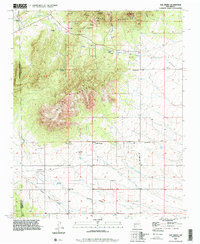
1990 Map of San Pedro
USGS Topo · Published 1996About this map
San Pedro Mountain and South Mountain dominate this high-desert landscape on the border of Santa Fe and Bernalillo counties. The map captures a region defined by historical transit and extraction, where the Old Stagecoach Road and an Old Railroad Grade cut across the basin floors of Homes Valley and the surrounding plains. The settlement pattern is sparse, centered on legacy ranching operations like the Stewart Ranch and Simmons Ranch, alongside the mining activity evidenced by an Open Pit Mine and Mine Tailings near the northern slopes.
Find a feature on this map
31 named features on this map. Tap any name to fly to it.
Don’t see what you’re looking for? This feature index may not catch every label — zoom into the map to look around manually.
Map Details
Editions of this 1990 San Pedro Map
This is the sole edition of this map. No revisions or reprints were ever made.
Other maps of this area

1892 · San Pedro
USGS Topo · 1:125,000

1954 · Sandia Park
USGS Topo · 1:24,000

1954 · San Pedro
USGS Topo · 1:24,000

1954 · Sedillo
USGS Topo · 1:24,000

1954 · Hagan
USGS Topo · 1:24,000

1954 · Edgewood
USGS Topo · 1:24,000

1954 · San Felipe Pueblo
USGS Topo · 1:62,500

1956 · Edgewood
USGS Topo · 1:62,500

1958 · Albuquerque
USGS Topo · 1:250,000

1961 · Madrid
USGS Topo · 1:62,500