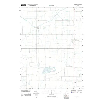
2010 Map of San Pierre
USGS Topo · Published 2010About this map
The Kankakee River defines the northern landscape of this region, winding through a complex system of drainage infrastructure that has long supported local agriculture. This network of canals includes the Heimberg Ditch, Mylius Ditch, and Elkheim Ditch, reflecting the engineered water management essential to the terrain. Small settlements like San Pierre and Tefft serve as primary hubs, connected by a grid of rural roads and rail corridors. To the south, the community of Radioville and the crossing at Clarks anchor the lower portion of the sheet. For genealogists and local historians, All Saints Cemetery provides a specific point of interest north of the main village center. The map also captures several family-named landmarks and smaller waterways, such as the Ryan Kraisinger Ditch and Luken Ditch, illustrating the localized nature of land division and water rights in this part of Indiana.
Find a feature on this map
46 named features on this map. Tap any name to fly to it.
Don’t see what you’re looking for? This feature index may not catch every label — zoom into the map to look around manually.
Map Details
Editions of this 2010 San Pierre Map
This is the sole edition of this map. No revisions or reprints were ever made.
Other maps of this area

1953 · Kouts
USGS Topo · 1:24,000

1953 · Chicago
USGS Topo · 1:250,000

1957 · Chicago
USGS Topo · 1:250,000

1957 · Wheatfield
USGS Topo · 1:24,000

1958 · La Crosse
USGS Topo · 1:24,000

1959 · English Lake
USGS Topo · 1:24,000

1959 · North Judson
USGS Topo · 1:24,000

1959 · San Pierre
USGS Topo · 1:24,000

1962 · Medaryville
USGS Topo · 1:24,000

1962 · Gifford
USGS Topo · 1:24,000