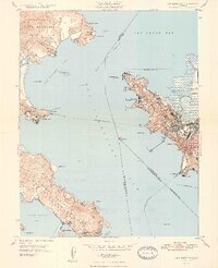
1948 Map of San Quentin
USGS Topo · Published 1948About this map
The waters of San Pablo Strait and San Francisco Bay define this 1948 survey, showcasing a landscape of naval installations and vital ferry crossings. On the western shore, the State Penitentiary sits at Pt San Quentin, while the southern tip of the Tiburon Peninsula is anchored by the Tiburon Naval Net Depot and the neighboring settlements of Belvedere and Tiburon. This era precedes the modern bridge, relying instead on the Richmond-San Rafael Ferry to connect the Marin and Contra Costa coastlines.
Find a feature on this map
58 named features on this map. Tap any name to fly to it.
Don’t see what you’re looking for? This feature index may not catch every label — zoom into the map to look around manually.
Map Details
Editions of this 1948 San Quentin Map
2 editions found
Other maps of this area

1895 · San Francisco
USGS Topo · 1:62,500

1897 · Tamalpais
USGS Topo · 1:62,500

1899 · San Francisco
USGS Topo · 1:62,500

1902 · Napa
USGS Topo · 1:125,000

1914 · Petaluma
USGS Topo · 1:62,500

1915 · San Francisco
USGS Topo · 1:62,500

1916 · Mare Island
USGS Topo · 1:62,500

1941 · Tamalpais
USGS Topo · 1:62,500

1942 · Mare Island
USGS Topo · 1:62,500

1942 · Petaluma
USGS Topo · 1:62,500