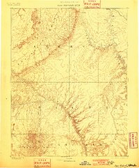
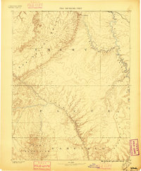
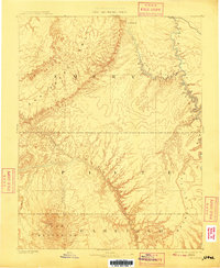
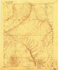
1885 Map of San Rafael
USGS Topo · Published 1901About this map
San Rafael River and the winding Green River dominate this late nineteenth-century reconnaissance of southeastern Utah. The terrain is defined by the massive Swell and the jagged Orange Cliffs, showing a landscape where water and rock dictate the paths of early travel and commerce. The Rio Grande Western Ry cuts across the northern edge of the sheet, connecting the isolated settlements of Tidwell and Blake to the wider world.
Find a feature on this map
18 named features on this map. Tap any name to fly to it.
Don’t see what you’re looking for? This feature index may not catch every label — zoom into the map to look around manually.
Map Details
Editions of this 1885 San Rafael Map
5 editions found
Other maps of this area

1885 · San Rafael
USGS Topo · 1:250,000

1885 · Manti
USGS Topo · 1:250,000

1885 · East Tavaputs
USGS Topo · 1:250,000

1885 · La Sal
USGS Topo · 1:250,000

1885 · Fish Lake
USGS Topo · 1:250,000

1886 · Escalante
USGS Topo · 1:250,000

1886 · Henry Mountains
USGS Topo · 1:250,000

1886 · Price River
USGS Topo · 1:250,000

1886 · Abajo
USGS Topo · 1:250,000

1892 · Abajo
USGS Topo · 1:250,000