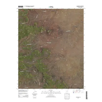
2013 Map of San Ramon
USGS Topo · Published 2013About this map
San Ramon sits at the heart of this San Miguel County landscape, characterized by a series of high-desert drainage systems and scattered ranching settlements. The map illustrates a network of seasonal watercourses such as Trementina Cr and Lagartija Cr, which have historically dictated the placement of small outposts like Quintana and Maestas. Significant topographical features such as Los Cerritos and the deep cuts of Four V Canyon dominate the western half of the quadrangle, where the terrain transitions into the namesake Las Cañadas. The presence of established locations like Mesteño Camp and Waggoner reflects a long-standing pattern of land use tied to the region's geography. Transportation is anchored by NM-419, which provides the primary north-south artery through this sparsely populated stretch of northeastern New Mexico.
Find a feature on this map
21 named features on this map. Tap any name to fly to it.
Don’t see what you’re looking for? This feature index may not catch every label — zoom into the map to look around manually.
Map Details
Editions of this 2013 San Ramon Map
This is the sole edition of this map. No revisions or reprints were ever made.
Other maps of this area

1892 · Watrous
USGS Topo · 1:125,000

1892 · Corazon
USGS Topo · 1:125,000

1894 · Corazon
USGS Topo · 1:125,000

1894 · Watrous
USGS Topo · 1:125,000

1954 · Santa Fe
USGS Topo · 1:250,000

1958 · Santa Fe
USGS Topo · 1:250,000

1971 · Canon Olguin
USGS Topo · 1:24,000

1972 · Variadero
USGS Topo · 1:24,000

1972 · Four V Ranch
USGS Topo · 1:24,000

1972 · Arroyo Alamocito
USGS Topo · 1:24,000