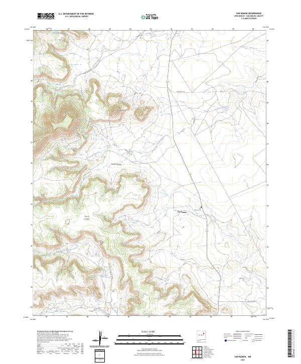
2023 Map of San Ramon
USGS Topo · Published 2023About this map
The small settlement of San Ramon and the nearby San Ramon Cem serve as focal points in this arid pocket of San Miguel County. The landscape is defined by its deep drainages and canyons, including Cañon Sanchez and Four V Canyon, which carve through the high terrain. The Sabinoso Wilderness occupies the western edge of the quadrangle, preserving a complex system of rimrock and mesas that remain largely inaccessible by modern vehicle routes. To the north, Los Cerritos marks another point of human settlement amidst the sprawling network of ephemeral waterways like Lagartija Creek and Arroyo del Mesteño. This area is connected primarily by State Hwy 419 and local routes such as Co Rd C56A Corazon, which trace the natural contours of the high plains and canyon floors.
Find a feature on this map
18 named features on this map. Tap any name to fly to it.
Don’t see what you’re looking for? This feature index may not catch every label — zoom into the map to look around manually.
Map Details
Editions of this 2023 San Ramon Map
This is the sole edition of this map. No revisions or reprints were ever made.
Other maps of this area

1892 · Watrous
USGS Topo · 1:125,000

1892 · Corazon
USGS Topo · 1:125,000

1894 · Corazon
USGS Topo · 1:125,000

1894 · Watrous
USGS Topo · 1:125,000

1954 · Santa Fe
USGS Topo · 1:250,000

1958 · Santa Fe
USGS Topo · 1:250,000

1971 · Canon Olguin
USGS Topo · 1:24,000

1972 · Variadero
USGS Topo · 1:24,000

1972 · Four V Ranch
USGS Topo · 1:24,000

1972 · Arroyo Alamocito
USGS Topo · 1:24,000