
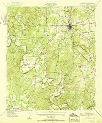
1925 Map of San Saba 4-a
USGS Topo · Published 1925About this map
The Colorado River and San Saba River converge in this central Texas landscape, creating a series of deep bends and steep-walled hollows as they carve through the limestone terrain. The 1925 topography reveals a rural society built around these waterways, with river fords such as Red Bluff Crossing, Hicks Crossing, and Rough Creek Crossing serving as critical transit points. Small community hubs are anchored by local institutions like the Colony School and McAnnelly Bend School, while the Bend Cem serves the nearby settlement of Bend. The Gulf Colorado and Santa Fe RR cuts a north-south path through the center of the sheet, bridging the gap between San Saba and Mills counties and bypassing the more traditional riverfront communities like McAnnelly and Chadwick.
Find a feature on this map
36 named features on this map. Tap any name to fly to it.
Don’t see what you’re looking for? This feature index may not catch every label — zoom into the map to look around manually.
Map Details
Editions of this 1925 San Saba 4-a Map
This is the sole edition of this map. No revisions or reprints were ever made.
Other maps of this area

1885 · San Saba
USGS Topo · 1:125,000

1887 · Lampasas
USGS Topo · 1:125,000

1894 · Lampasas
USGS Topo · 1:125,000

1894 · San Saba
USGS Topo · 1:125,000

1925 · San Saba 1-c
USGS Topo · 1:48,000

1925 · San Saba 1-d
USGS Topo · 1:48,000

1928 · Goldthwaite
USGS Topo · 1:62,500

1931 · Bend
USGS Topo · 1:62,500

1948 · Goldthwaite
USGS Topo · 1:62,500
1950 · Goldthwaite
USGS Topo · 1:62,500