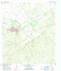
1959 Map of San Saba
USGS Topo · Published 1991About this map
The San Saba townsite serves as the focal point of this 1950s survey, situated along the northern banks of the winding San Saba River. The map captures the community during a period of mid-century development, evidenced by the municipal Filtration Plant, a Radio Tower (KBAL), and the Drive-in Theater located south of the main settlement. Genealogy researchers will find significant value in the documentation of numerous family and community burial sites, including Terry Cem, Linn Cem, Brown Cem, and the County Cem.
Find a feature on this map
50 named features on this map. Tap any name to fly to it.
Don’t see what you’re looking for? This feature index may not catch every label — zoom into the map to look around manually.
Map Details
Editions of this 1959 San Saba Map
3 editions found
Other maps of this area

1885 · San Saba
USGS Topo · 1:125,000

1894 · San Saba
USGS Topo · 1:125,000

1925 · San Saba 4-a
USGS Topo · 1:48,000

1925 · San Saba 1-c
USGS Topo · 1:48,000

1925 · San Saba 1-d
USGS Topo · 1:48,000

1928 · Goldthwaite
USGS Topo · 1:62,500

1930 · Richland Springs
USGS Topo · 1:62,500

1931 · Bend
USGS Topo · 1:62,500

1948 · Richland Springs
USGS Topo · 1:62,500

1948 · Goldthwaite
USGS Topo · 1:62,500