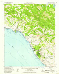
1959 Map of San Simeon
USGS Topo · Published 1961About this map
Hearst Castle and the expansive Hearst San Simeon State Historical Mon dominate the coastal hills of northern San Luis Obispo County in this late-1950s survey. The landscape transitions from the Pacific shoreline along the Cabrillo Highway to the steep peaks of the Santa Lucia Range, including Rocky Butte and Pine Mountain. This period shows the region's diverse land use, from the agricultural and ranching operations at Hearst Ranch to the industrial presence of the Buckeye and Almaden mines tucked into the canyons. Further south, the map details the growing community of Cambria, noting essential civic landmarks like the Coast Union High Sch, the Cambria Cemetery, and the nearby Cambria Air Force Station, reflecting the Cold War era's impact on this coastal stretch.
Find a feature on this map
61 named features on this map. Tap any name to fly to it.
Don’t see what you’re looking for? This feature index may not catch every label — zoom into the map to look around manually.
Map Details
Editions of this 1959 San Simeon Map
2 editions found
Other maps of this area

1897 · Cayucos
USGS Topo · 1:62,500

1900 · San Luis
USGS Topo · 1:125,000

1919 · Bryson
USGS Topo · 1:62,500

1919 · Bradley
USGS Topo · 1:62,500

1919 · Adelaida
USGS Topo · 1:62,500

1919 · Piedras Blancas
USGS Topo · 1:62,500

1919 · San Simeon
USGS Topo · 1:62,500

1921 · Cape San Martin
USGS Topo · 1:62,500

1927 · Piedras Blancas
USGS Topo · 1:62,500

1932 · Adelaida
USGS Topo · 1:62,500