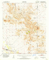
1950 Map of San Simon
USGS Topo · Published 1955About this map
San Simon sits along the Southern Pacific railroad at the mid-century, serving as a hub in a landscape defined by desert water sources and hard-rock mining. The topography transitions from the banks of San Simon Creek to the high elevations of the Peloncillo Mountains, where Steins Peak overlooks the border between Arizona and New Mexico. This era reveals a network of remote ranching outposts and historical waypoints, including the Old Stage Station and Braidfoot Ranch.
Find a feature on this map
71 named features on this map. Tap any name to fly to it.
Don’t see what you’re looking for? This feature index may not catch every label — zoom into the map to look around manually.
Map Details
Editions of this 1950 San Simon Map
2 editions found
Other maps of this area

1917 · San Simon
USGS Topo · 1:125,000

1926 · Cochise Head
USGS Topo · 1:62,500

1926 · Orange Butte
USGS Topo · 1:62,500

1928 · Chenoweth
USGS Topo · 1:62,500

1928 · Bowie
USGS Topo · 1:62,500

1949 · Bowie
USGS Topo · 1:62,500

1950 · San Simon
USGS Topo · 1:62,500

1950 · Bowie
USGS Topo · 1:62,500

1950 · Cochise Head
USGS Topo · 1:62,500

1950 · Vanar
USGS Topo · 1:62,500