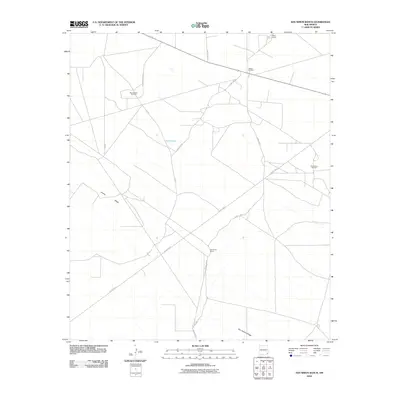
2010 Map of San Simon Ranch
USGS Topo · Published 2010About this map
The San Simon Ranch and its namesake ridge define this corner of Lea County, where ranching heritage meets the infrastructure of the Permian Basin's energy industry. During this era, the landscape is marked by a network of county roads like County Rd-31 and County Rd-32 that connect specialized settlements and industrial outposts. The map reveals the extent of local petroleum extraction, documenting the West Wilson Oil Field, the Wilson Oil Field, and the San Simon Oil Field.
Find a feature on this map
15 named features on this map. Tap any name to fly to it.
Don’t see what you’re looking for? This feature index may not catch every label — zoom into the map to look around manually.
Map Details
Editions of this 2010 San Simon Ranch Map
This is the sole edition of this map. No revisions or reprints were ever made.
Other maps of this area

1954 · Hobbs
USGS Topo · 1:250,000

1958 · Hobbs
USGS Topo · 1:250,000

1963 · Oil Center
USGS Topo · 1:62,500

1963 · Monument
USGS Topo · 1:62,500

1963 · Laguna Gatuna
USGS Topo · 1:62,500

1963 · Hat Mesa
USGS Topo · 1:62,500

1978 · Jal
USGS Topo · 1:100,000

1984 · Oil Center
USGS Topo · 1:24,000

1984 · Lea
USGS Topo · 1:24,000
1984 · Tip Top Wells
USGS Topo · 1:24,000