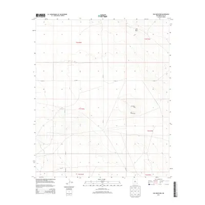
2013 Map of San Simon Sink
USGS Topo · Published 2013About this map
San Simon Sink forms the topographical centerpiece of this Lea County landscape, a notable depression in a region defined by its subtle arid relief. This 2013 survey by the U.S. Geological Survey illustrates the transition from the elevated San Simon Ridge in the north to the broad, shallow San Simon Swale that trends through the center of the sheet. The map reveals a systematic grid of range and township boundaries, including t23s r34e and t23s r35e, which organize the high plains of southeast New Mexico. While the terrain appears sparsely populated, a network of local thoroughfares such as Co Road 21, Antelope Rd, and Shell Rd provides access across the desert floor, suggesting the underlying importance of ranching or energy infrastructure in this portion of the Permian Basin.
Find a feature on this map
14 named features on this map. Tap any name to fly to it.
Don’t see what you’re looking for? This feature index may not catch every label — zoom into the map to look around manually.
Map Details
Editions of this 2013 San Simon Sink Map
This is the sole edition of this map. No revisions or reprints were ever made.
Other maps of this area

1954 · Hobbs
USGS Topo · 1:250,000

1958 · Hobbs
USGS Topo · 1:250,000

1963 · Oil Center
USGS Topo · 1:62,500

1963 · Hat Mesa
USGS Topo · 1:62,500

1973 · Bell Lake
USGS Topo · 1:24,000

1973 · Custer Mountain
USGS Topo · 1:24,000
1973 · Woodley Flat
USGS Topo · 1:24,000

1978 · Jal
USGS Topo · 1:100,000

1984 · Oil Center
USGS Topo · 1:24,000
1984 · Tip Top Wells
USGS Topo · 1:24,000