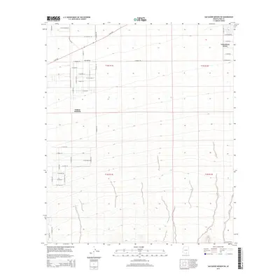
2014 Map of San Xavier Mission SW
USGS Topo · Published 2014About this map
The Avra Valley landscape in Pima County reveals a mix of growing residential development and open desert terrain as it appeared in the early 21st century. The unincorporated community of Valencia West sits in the northeast, while the settlement of Three Points anchors the central west, connected by the prominent corridor of W Ajo Hwy. The map details an evolving grid of residential streets with evocative local names such as W Gunsmoke Rd, Rustler Rd, and W Jessica Rae Ln, contrasting with the large-scale survey boundaries of t15s r11e and t16s r12e. To the south, the landscape becomes increasingly open, marked by drainages and the distant reach of W Pima Mine Rd, showing the transition from suburban outskirts to the more isolated reaches of the Sonoran Desert.
Find a feature on this map
41 named features on this map. Tap any name to fly to it.
Don’t see what you’re looking for? This feature index may not catch every label — zoom into the map to look around manually.
Map Details
Editions of this 2014 San Xavier Mission SW Map
This is the sole edition of this map. No revisions or reprints were ever made.
Other maps of this area

1920 · Arivaca
USGS Topo · 1:125,000

1925 · Samaniego Peak
USGS Topo · 1:62,500

1925 · San Xavier
USGS Topo · 1:62,500

1934 · Tucson Mountains
USGS Topo · 1:125,000

1939 · Twin Buttes
USGS Topo · 1:62,500

1940 · Palo Alto Ranch
USGS Topo · 1:62,500

1941 · Twin Buttes
USGS Topo · 1:62,500

1941 · Cocoraque Butte
USGS Topo · 1:62,500

1943 · Cocoraque Butte
USGS Topo · 1:62,500

1943 · Palo Alto Ranch
USGS Topo · 1:62,500