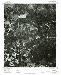
1976 Map of Sanatorium
USGS Topo · Published 1978About this map
Ashley Heights and Montrose anchor this 1976 orthophotograph of Hoke County, showcasing a landscape defined by the transition from dense woodland to active cultivation. Prepared in cooperation with the Soil Conservation Service, the imagery provides a clear look at the intricate network of farm lanes and field boundaries that characterized the region during the mid-1970s. The northern portion of the map is dominated by forest cover, punctuated by features like Mc Kiethan Pond, while the southern half reveals an intensive patchwork of agricultural clearings. This aerial perspective is particularly valuable for researchers tracing the physical evolution of local homesteads and timber tracts before late-century development altered the rural footprint of these Sandhills communities.
Find a feature on this map
3 named features on this map. Tap any name to fly to it.
Don’t see what you’re looking for? This feature index may not catch every label — zoom into the map to look around manually.
Map Details
Editions of this 1976 Sanatorium Map
This is the sole edition of this map. No revisions or reprints were ever made.
Other maps of this area

1948 · Southern Pines
USGS Topo · 1:62,500

1948 · Clifdale
USGS Topo · 1:62,500

1948 · Pinebluff
USGS Topo · 1:24,000

1948 · Nicholson Creek
USGS Topo · 1:24,000

1948 · Mc Cain
USGS Topo · 1:24,000

1949 · Wagram
USGS Topo · 1:24,000

1949 · Silver Hill
USGS Topo · 1:24,000

1949 · Laurinburg
USGS Topo · 1:62,500

1950 · Sanatorium
USGS Topo · 1:24,000

1950 · Lobelia
USGS Topo · 1:24,000