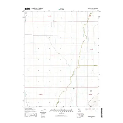
2015 Map of Sanborn Slough
USGS Topo · Published 2015About this map
Butte Creek meanders through the heart of the Sacramento Valley, anchoring a complex hydrologic network at the intersection of Butte, Sutter, and Colusa Counties. This 2015 survey illustrates a landscape dominated by agricultural water management and natural drainage, where the Sanborn Slough and Drumheller Slough provide critical irrigation and overflow paths across the Central Valley. To the southwest, the distinctive volcanic profiles of the Sutter Buttes begin to rise above the flat valley floor, marked by W Butte Rd and N Butte Rd. The western edge is defined by the Sacramento River at Boggs Bend, showing the deep connection between the river's path and the arterial road network, including River Rd and Gridley Rd, which serve the rural farmsteads and agricultural tracts of this fertile region.
Find a feature on this map
27 named features on this map. Tap any name to fly to it.
Don’t see what you’re looking for? This feature index may not catch every label — zoom into the map to look around manually.
Map Details
Editions of this 2015 Sanborn Slough Map
This is the sole edition of this map. No revisions or reprints were ever made.
Other maps of this area

1888 · Marysville
USGS Topo · 1:125,000

1891 · Marysville
USGS Topo · 1:125,000

1894 · Marysville
USGS Topo · 1:125,000

1895 · Marysville
USGS Topo · 1:125,000

1906 · Maxwell
USGS Topo · 1:62,500

1907 · Colusa
USGS Topo · 1:62,500

1911 · Sanborn Slough
USGS Topo · 1:31,680

1911 · Landlow
USGS Topo · 1:31,680

1912 · Marysville Buttes
USGS Topo · 1:31,680

1912 · Butte City
USGS Topo · 1:31,680