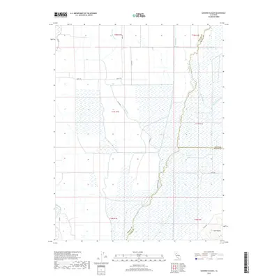
2018 Map of Sanborn Slough
USGS Topo · Published 2018About this map
Butte Sink dominates this low-lying landscape in the Sacramento Valley, where a complex network of waterways defines the territory. The map shows the convergence of Drumheller Slough, Sanborn Slough, and Butte Creek as they wind through a region heavily characterized by wetlands and drainage management. To the southeast, the rising elevations of the Sutter Buttes begin to emerge, providing a sharp contrast to the surrounding marshlands. A grid of rural roads, including Gridley Rd and Putnam Rd, cuts across the terrain, reflecting the agricultural and water-management infrastructure of the early 21st century. The map also delineates the precise meeting points of Butte, Colusa, and Sutter counties within this hydrologically significant area, where the Main Drainage Canal serves as a vital component of the local landscape.
Find a feature on this map
24 named features on this map. Tap any name to fly to it.
Don’t see what you’re looking for? This feature index may not catch every label — zoom into the map to look around manually.
Map Details
Editions of this 2018 Sanborn Slough Map
This is the sole edition of this map. No revisions or reprints were ever made.
Other maps of this area

1888 · Marysville
USGS Topo · 1:125,000

1891 · Marysville
USGS Topo · 1:125,000

1894 · Marysville
USGS Topo · 1:125,000

1895 · Marysville
USGS Topo · 1:125,000

1906 · Maxwell
USGS Topo · 1:62,500

1907 · Colusa
USGS Topo · 1:62,500

1911 · Sanborn Slough
USGS Topo · 1:31,680

1911 · Landlow
USGS Topo · 1:31,680

1912 · Marysville Buttes
USGS Topo · 1:31,680

1912 · Butte City
USGS Topo · 1:31,680