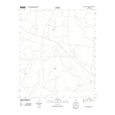
2010 Map of Sand Bluff Draw
USGS Topo · Published 2010About this map
The North Concho River winds through the heart of this Sterling County landscape, defining a ranching territory marked by expansive properties and intermittent waterways. Private landholdings like the Cole Ranch and Reed Ranch occupy the northern reaches of the sheet, while the McEntire Ranch is situated to the southeast, reflecting the sparse, large-scale settlement pattern characteristic of West Texas.
Find a feature on this map
14 named features on this map. Tap any name to fly to it.
Don’t see what you’re looking for? This feature index may not catch every label — zoom into the map to look around manually.
Map Details
Editions of this 2010 Sand Bluff Draw Map
This is the sole edition of this map. No revisions or reprints were ever made.
Other maps of this area

1941 · Big Spring South
USGS Topo · 1:62,500

1942 · Big Spring South
USGS Topo · 1:62,500

1954 · Big Spring
USGS Topo · 1:250,000

1954 · San Angelo
USGS Topo · 1:250,000

1958 · San Angelo
USGS Topo · 1:250,000

1958 · Big Spring
USGS Topo · 1:250,000

1963 · Cumbie Draw
USGS Topo · 1:24,000

1963 · Glass Ranch
USGS Topo · 1:24,000

1963 · Cumbie Draw NE
USGS Topo · 1:24,000

1963 · Buffalo Draw
USGS Topo · 1:24,000