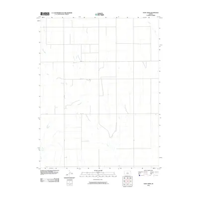
2010 Map of Sand Creek
USGS Topo · Published 2010About this map
Sand Creek winds through the heart of this western Kansas landscape, defining a drainage pattern characterized by intermittent waterways and broad, open terrain. In this portion of Hamilton County, the map reveals a strictly regulated grid of section lines and rural thoroughfares, such as Co Rd 13 and Co Rd 16, which anchor the agricultural landscape. The lack of concentrated settlements highlights the expansive, rural nature of the region during this era. To the northeast, Shirley Creek cuts across the plains, while Syracuse Creek appears in the southwestern corner, showing the natural flow toward the Arkansas River basin south of this quadrangle. This 2010 digital survey by the U.S. Geological Survey documents the precise placement of county roads like Rd U and Rd 19, providing a baseline for understanding the sparse infrastructure and land divisions in the high plains of the twenty-first century.
Find a feature on this map
11 named features on this map. Tap any name to fly to it.
Don’t see what you’re looking for? This feature index may not catch every label — zoom into the map to look around manually.
Map Details
Editions of this 2010 Sand Creek Map
This is the sole edition of this map. No revisions or reprints were ever made.
Other maps of this area

1900 · Syracuse
USGS Topo · 1:125,000

1920 · Syracuse
USGS Topo · 1:125,000

1955 · Dodge City
USGS Topo · 1:250,000

1955 · Scott City
USGS Topo · 1:250,000

1958 · Dodge City
USGS Topo · 1:250,000

1958 · Scott City
USGS Topo · 1:250,000

1959 · Dodge City
USGS Topo · 1:250,000

1966 · Syracuse East
USGS Topo · 1:24,000
1966 · Syracuse West
USGS Topo · 1:24,000

1966 · Tribune 4 NW
USGS Topo · 1:24,000