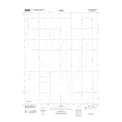
2012 Map of Sand Creek
USGS Topo · Published 2012About this map
Sand Cr and Syracuse Cr define the drainage patterns of this Hamilton County landscape, where the High Plains terrain is organized by a strict geometric grid of county roads. The mapping reveals a rural infrastructure dominated by long, straight thoroughfares such as Co Road S and Co Road Q, which facilitate movement across the agricultural expanse. This survey captures the region as it appeared in the early 21st century, illustrating how modern transportation and aviation needs, represented by the Syracuse-Hamilton County Municipal Airport in the southwest corner, integrate with the traditional section-line road system. The lack of concentrated settlements highlights the area's specialized land use, where the intersection of roads like Co Rd-11 and Co Road U provides the primary framework for local navigation and property boundaries.
Find a feature on this map
18 named features on this map. Tap any name to fly to it.
Don’t see what you’re looking for? This feature index may not catch every label — zoom into the map to look around manually.
Map Details
Editions of this 2012 Sand Creek Map
This is the sole edition of this map. No revisions or reprints were ever made.
Other maps of this area

1900 · Syracuse
USGS Topo · 1:125,000

1920 · Syracuse
USGS Topo · 1:125,000

1955 · Dodge City
USGS Topo · 1:250,000

1955 · Scott City
USGS Topo · 1:250,000

1958 · Dodge City
USGS Topo · 1:250,000

1958 · Scott City
USGS Topo · 1:250,000

1959 · Dodge City
USGS Topo · 1:250,000

1966 · Syracuse East
USGS Topo · 1:24,000
1966 · Syracuse West
USGS Topo · 1:24,000

1966 · Tribune 4 NW
USGS Topo · 1:24,000