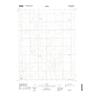
2018 Map of Sand Creek
USGS Topo · Published 2018About this map
Syracuse-Hamilton County Municipal Airport occupies the southwestern corner of this landscape in western Kansas, representing a modern anchor in a high plains region defined by its drainage systems and section-line roads. The topography is shaped by the winding courses of Sand Cr and Syracuse Cr, which cut through the terrain as they flow toward larger basins. A rigid network of rural routes, including Co RD 13, Co RD 14, and RD 19, divides the land into the traditional township and range grid system. This infrastructure supports the agricultural and aviation needs of Hamilton County, illustrating how the vast open prairie has been organized for transportation and navigation in the early twenty-first century.
Find a feature on this map
15 named features on this map. Tap any name to fly to it.
Don’t see what you’re looking for? This feature index may not catch every label — zoom into the map to look around manually.
Map Details
Editions of this 2018 Sand Creek Map
This is the sole edition of this map. No revisions or reprints were ever made.
Other maps of this area

1900 · Syracuse
USGS Topo · 1:125,000

1920 · Syracuse
USGS Topo · 1:125,000

1955 · Dodge City
USGS Topo · 1:250,000

1955 · Scott City
USGS Topo · 1:250,000

1958 · Dodge City
USGS Topo · 1:250,000

1958 · Scott City
USGS Topo · 1:250,000

1959 · Dodge City
USGS Topo · 1:250,000

1966 · Syracuse East
USGS Topo · 1:24,000
1966 · Syracuse West
USGS Topo · 1:24,000

1966 · Tribune 4 NW
USGS Topo · 1:24,000