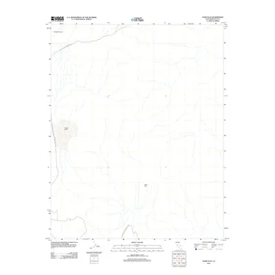
2012 Map of Sand Flat
USGS Topo · Published 2012About this map
Death Valley National Park encompasses the majority of this arid landscape in Inyo County, defining a region characterized by dramatic elevation changes and sparse desert infrastructure. The topography is dominated by the broad, low-lying expanse of Sand Flat to the south and the secluded depression of Hidden Valley nestled between the mountain ranges to the west. Water drainage patterns are marked by seasonal features like Perdido Canyon, which cuts through the northern terrain. Human activity is minimal and focused on primitive transit, represented primarily by Hunter Mountain Rd winding along the western edge of the quadrangle. This 2012 survey provides a detailed record of the natural contours and preserved park boundaries as they stood in the early twenty-first century.
Find a feature on this map
5 named features on this map. Tap any name to fly to it.
Don’t see what you’re looking for? This feature index may not catch every label — zoom into the map to look around manually.
Map Details
Editions of this 2012 Sand Flat Map
This is the sole edition of this map. No revisions or reprints were ever made.
Other maps of this area

1908 · Ballarat
USGS Topo · 1:250,000

1913 · Ballarat
USGS Topo · 1:250,000

1948 · Death Valley
USGS Topo · 1:250,000

1950 · Ubehebe Peak
USGS Topo · 1:62,500

1951 · Ubehebe Peak
USGS Topo · 1:62,500

1951 · Marble Canyon
USGS Topo · 1:62,500

1954 · Death Valley
USGS Topo · 1:250,000

1956 · Death Valley
USGS Topo · 1:250,000

1957 · Death Valley
USGS Topo · 1:250,000

1957 · Tin Mountain
USGS Topo · 1:62,500