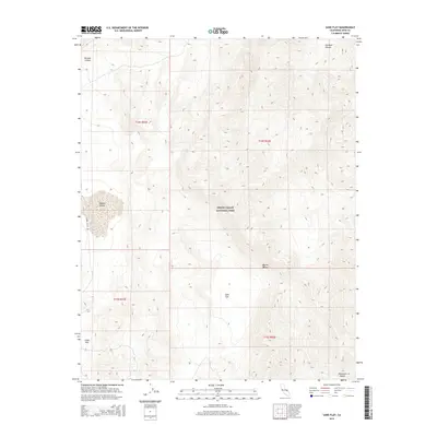
2015 Map of Sand Flat
USGS Topo · Published 2015About this map
Death Valley National Park encompasses the central portion of this 2015 study, illustrating a high-desert environment defined by vast alluvial basins and steep mountain slopes. The terrain is dominated by wide, low-lying features such as Sand Flat and Ulida Flat, which represent significant drainage sinks within this arid landscape. To the west, the winding path of Hidden Valley Rd provides the primary access route through Hidden Valley, a distinct topographic depression flanked by the rising peaks of the Panamint Range. North of these flats, the map documents the erosional features of the region, including Perdido Canyon and Dry Bone Canyon. This survey captures the characteristic topography of the northern Mojave Desert, where the stark transition between canyon floors and mountain ridges dictates the primitive road network and land use patterns.
Find a feature on this map
13 named features on this map. Tap any name to fly to it.
Don’t see what you’re looking for? This feature index may not catch every label — zoom into the map to look around manually.
Map Details
Editions of this 2015 Sand Flat Map
This is the sole edition of this map. No revisions or reprints were ever made.
Other maps of this area

1908 · Ballarat
USGS Topo · 1:250,000

1913 · Ballarat
USGS Topo · 1:250,000

1948 · Death Valley
USGS Topo · 1:250,000

1950 · Ubehebe Peak
USGS Topo · 1:62,500

1951 · Ubehebe Peak
USGS Topo · 1:62,500

1951 · Marble Canyon
USGS Topo · 1:62,500

1954 · Death Valley
USGS Topo · 1:250,000

1956 · Death Valley
USGS Topo · 1:250,000

1957 · Death Valley
USGS Topo · 1:250,000

1957 · Tin Mountain
USGS Topo · 1:62,500